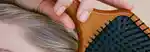
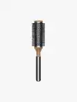
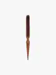
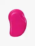
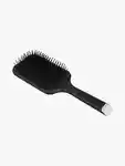
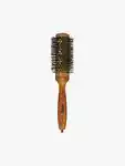
Moon 101 Great Hikes San Francisco Bay Area

Contributors

By Ann Marie Brown

Formats and Prices

Price

$19.99

Price

$25.99 CAD

Format

Format:

  1. Trade Paperback $19.99 $25.99 CAD
  2. ebook $13.99 $17.99 CAD

Moon Travel Guides: Your Adventure Starts Here

Whether you’re trekking through the wildflowers of the South Bay or the redwood forests of Marin, get a breath of fresh air with Moon 101 Great Hikes San Francisco Bay Area.

  • Flexible Hiking Options: Hikes range from short, flat routes suitable for families to day-long, steep treks for more ambitious hikers, with options to extend or shorten many routes
  • Explore the Trails: All hikes are marked with difficulty ratings, features (such as dog-friendly or wheelchair-accessible) and highlights like waterfalls, beaches, historic sites, wildlife, and wildflowers
  • Maps and Directions: Follow easy-to-use maps and point-by-point navigation for each trail, including driving directions to trailheads, GPS coordinates, and public transit options when available
  • Top Hikes: Strategic lists like ” Waterfalls,” “Short Backpacking Trips,” “Peak Vistas,” and more will help you choose the right hike for you in Napa, Sonoma, Marin, the East Bay, San Francisco, the Peninsula, and the South Bay
  • Trusted Advice: Ann Marie Brown shares the experience and knowledge she’s gained from hiking, biking, and camping in and around the Bay Area more than 150 days a year
  • Tips and Tools: Find essentials like health and safety information, trail etiquette, background on the landscape and history of the trails, and volunteer opportunities so you can help keep the trails as beautiful as you found them
Whether you’re a veteran or a first-time hiker, Moon’s practical tips and comprehensive coverage will have you ready to lace up your boots and hit the trails.

Looking for hikes beyond the Bay? Try Moon Northern California Hiking or Moon California Hiking. Ready for an overnight adventure? Check out Moon Northern California Camping or Moon California Camping.

Excerpt

How to Use This Book

ABOUT THE MAPS

This book is divided into chapters based on regions that are within close reach of the city; an overview map of these regions precedes the table of contents. Each chapter begins with a region map that shows the locations and numbers of the trails listed in that chapter.

Each trail profile is also accompanied by a detailed trail map that shows the hike route.

Map Symbols

ABOUT THE TRAIL PROFILES

Each profile includes a narrative description of the trail’s setting and terrain. This description also typically includes mile-by-mile hiking directions, as well as information about the trail’s highlights and unique attributes.

The mileage and elevation for each hike as measured with a Garmin GPSMAP 64st. The elevation gain for each hike is cumulative; all the bumps and hills that you’ll ascend throughout the hike are counted in the overall elevation gain.

In addition to the featured trail, each listing includes options on how to shorten or lengthen the hike, where to hike nearby, or how to extend the hike into a day trip or get away for the weekend.

Detailed driving directions are provided from the city center or from the intersection of major highways to the trailhead. GPS coordinates are included for the trailhead. When public transportation is available, instructions are noted after the directions.

ABOUT THE ICONS

The icons in this book are designed to provide at-a-glance information on special features for each trail.

The trail offers an opportunity for wildlife watching.
The trail features wildflower displays in spring.
The trail travels to a waterfall.
The trail visits a historic site.
Dogs are allowed.
The trail is appropriate for children.
The trail is wheelchair accessible.
The trailhead can be accessed via public transportation.

ABOUT THE DIFFICULTY RATING

Each profile includes a difficulty rating. Definitions for ratings follow. Remember that the difficulty level for any trail can change due to weather or trail conditions, so always phone ahead to check the current state of any trail.

Easy: Easy hikes are 4 miles or less and with an elevation gain or loss of 500 feet.

Easy/Moderate: Easy/Moderate hikes are 4–6 miles long and with an elevation gain or loss of 500–1,000 feet.

Moderate: Moderate hikes are 2–8 miles long and with an elevation gain or loss of 1,000–1,500 feet.

Strenuous: Strenuous hikes are 6–10 miles long and with an elevation gain or loss of 1,000–2,000 feet.

Butt-kicker: Butt-kicker hikes are 8–14 miles long with an elevation gain or loss of 2,000 feet or more.


INTRODUCTION

Author’s Note

Best Hikes

BEST FOR BIRD-WATCHING

BEST FOR PEAK VISTAS

BEST FOR REDWOOD FORESTS

BEST SHORT BACKPACKING TRIPS

BEST FOR WATERFALLS

BEST FOR WILDFLOWER DISPLAYS

BEST FOR WILDLIFE-WATCHING

Hiking Tips

HIKING ESSENTIALS

ON THE TRAIL

Author’s Note

I’m a nature lover, a wildlife-watcher, a committed hiker, and a card-carrying member of the Sierra Club and Audubon Society. I run my life’s appointment calendar by the timing of the wildflower bloom, the flow of waterfalls, and the show of autumn colors. I spend my work days and play days doing basically the same thing—exploring the natural world.

This being the case, it may seem odd that I chose to write a book about a large urban area packed with nearly seven million people. But the San Francisco Bay Area is the wildest metropolitan area in the United States, with precious swaths of open space surrounding and interspersed amid its urban and suburban core. Although grizzly bears no longer roam the Bay Area as they did 150 years ago, coyotes still gallop across the grasslands, herds of tule elk wander the coastal hills, badgers build their underground dens, and mountain lions and bobcats stalk their prey. Elephant seals still breed on the Bay Area’s beaches, river otters ply the waterways, and peregrine falcons, American kestrels, and golden and bald eagles soar overhead.

In the course of hiking the 101 trails in this book, I saw all of these creatures and more.

If you hike much in the Bay Area, you will be awed by the beauty and grace of centuries-old virgin redwoods. You’ll wonder at the sight of rare and precious wildflowers, some of which grow here and nowhere else in the world. Your ears will be filled with the sound of crashing surf against miles of jagged coastal bluffs. You’ll gaze at waterfalls coursing down basalt cliffs, pouring over sandstone precipices, and even dashing to the sea. You’ll stand on summits and look down thousands of feet to the valleys below. In autumn, you’ll watch black oaks and big-leaf maples turn bright gold, and in winter, you’ll see a dusting of snow fall on the Bay Area’s high peaks and ridges.

Quite possibly, you’ll wind up spending some of the best days of your life on Bay Area trails. I know I have.

Speaking of hiking, take a look out the window. Chances are good that it’s a nice day for a walk. See you out there.

—Ann Marie Brown

Best Hikes

Can’t decide where to hike this weekend? I’ve grouped these unique Bay Area hikes into some of my favorite categories.

Best for Bird-Watching

Lake Ilsanjo Loop, Trione-Annadel State Park, Napa and Sonoma, tap here

Marsh and South Pasture Loop, Rush Ranch, Solano Land Trust, Napa and Sonoma, tap here

Abbotts Lagoon, Point Reyes National Seashore, Marin, tap here

Estero Trail to Sunset Beach, Point Reyes National Seashore, Marin, tap here

Kent, Griffin, and Zumie Loop Trails, Audubon Canyon Ranch/Martin Griffin Preserve, Marin, tap here

Lagoon Trail, Golden Gate National Recreation Area, Marin, tap here

Rock City and Wall Point Summit, Mount Diablo State Park, East Bay, tap here

Bayview and Red Hill Loop, Coyote Hills Regional Park, East Bay, tap here

Sunol Loop Tour, Sunol Regional Wilderness, East Bay, tap here

Alcatraz Island’s Agave Trail, Golden Gate National Recreation Area, Peninsula and South Bay, tap here

Sequoia Audubon Trail, Pescadero Marsh Natural Preserve, Peninsula and South Bay, tap here

Best for Peak Vistas

Bald Mountain Loop, Sugarloaf Ridge State Park, Napa and Sonoma, tap here

Mount St. Helena, Robert Louis Stevenson State Park, Napa and Sonoma, tap here

Table Rock, Robert Louis Stevenson State Park, Napa and Sonoma, tap here

Barnabe Peak Loop, Samuel P. Taylor State Park, Marin, tap here

Verna Dunshee Trail and Gardner Lookout, Mount Tamalpais State Park, Marin, tap here

Coastal Trail and Hill 88 Loop, Golden Gate National Recreation Area, Marin, tap here

North Ridge and Sunset Trail Loop, Angel Island State Park, Marin, tap here

Wildcat Peak and Laurel Canyon Loop, Tilden Regional Park, East Bay, tap here

Mount Diablo Grand Loop, Mount Diablo State Park, East Bay, tap here

Mission Peak, Mission Peak Regional Preserve, East Bay, tap here

Montara Mountain Summit, McNee Ranch State Park and Montara State Beach, Peninsula and South Bay, tap here

Best for Redwood Forests

Matt Davis and Steep Ravine Loop, Mount Tamalpais State Park, Marin, tap here

Bootjack, Ben Johnson, and Hillside Trail Loop, Muir Woods National Monument and Mount Tamalpais State Park, Marin, tap here

Stream, Fern, and West Ridge Trail Loop, Redwood Regional Park, East Bay, tap here

Purisima Grand Loop, Peninsula and South Bay, tap here

Peters Creek Grove, Portola Redwoods State Park, Peninsula and South Bay, tap here

Heritage Grove and Hiker’s Hut Loop, Sam McDonald County Park, Peninsula and South Bay, tap here

Berry Creek, Silver, and Golden Falls, Big Basin Redwoods State Park, Peninsula and South Bay, tap here

Best Short Backpacking Trips

Sky Trail and Woodward Valley Loop, Point Reyes National Seashore, Marin, tap here

Coast, Fire Lane, and Laguna Loop, Point Reyes National Seashore, Marin, tap here

North Ridge and Sunset Trail Loop, Angel Island State Park, Marin, tap here

Stewartville and Ridge Trail Loop, Black Diamond Mines Regional Preserve, East Bay, tap here

Black Mountain and Stevens Creek Loop, Monte Bello Open Space Preserve, Peninsula and South Bay, tap here

Peters Creek and Long Ridge Loop, Long Ridge Open Space Preserve, Peninsula and South Bay, tap here

Saratoga Gap and Ridge Trail Loop, Castle Rock State Park, Peninsula and South Bay, tap here

Butano Grand Loop, Butano State Park, Peninsula and South Bay, tap here

Berry Creek, Silver, and Golden Falls, Big Basin Redwoods State Park, Peninsula and South Bay, tap here

Flat Frog, Middle Ridge, and Fish Trail Loop, Henry W. Coe State Park, Peninsula and South Bay, tap here

Best for Waterfalls

Zim Zim Falls, Knoxville Wildlife Area, Napa and Sonoma, tap here

Barnabe Peak Loop, Samuel P. Taylor State Park, Marin, tap here

Bass Lake and Alamere Falls, Point Reyes National Seashore, Marin, tap here

Cataract Trail to Cataract Falls, Marin Municipal Water District, Marin, tap here

Carson Falls, Marin Municipal Water District, Marin, tap here

Cascade Canyon, Marin County Open Space District, Marin, tap here

Back and Donner Canyon Loop, Mount Diablo State Park, East Bay, tap here

Murietta Falls, Ohlone Regional Wilderness, East Bay, tap here

Saratoga Gap and Ridge Trail Loop, Castle Rock State Park, Peninsula and South Bay, tap here

Berry Creek, Silver, and Golden Falls, Big Basin Redwoods State Park, Peninsula and South Bay, tap here

Loma Prieta Grade and Bridge Creek Loop, The Forest of Nisene Marks State Park, Peninsula and South Bay, tap here

Waterfall Loop Trail, Uvas Canyon County Park, Peninsula and South Bay, tap here

Best for Wildflower Displays

Pomo Canyon Trail, Sonoma Coast State Park, Napa and Sonoma, tap here

Goodspeed/Nattkemper Trail to Gunsight Rock, Sugarloaf Ridge State Park and Hood Mountain Regional Park, Napa and Sonoma, tap here

Chimney Rock, Point Reyes National Seashore, Marin, tap here

Coastal, Cataract, and Old Mine Loop, Mount Tamalpais State Park, Marin, tap here

Phyllis Ellman Trail, Ring Mountain Open Space Preserve, Marin, tap here

Morgan Territory Loop, Morgan Territory Regional Preserve, East Bay, tap here

Sunol Loop Tour, Sunol Regional Wilderness, East Bay, tap here

Summit Loop Trail, San Bruno Mountain State and County Park, Peninsula and South Bay, tap here

Russian Ridge Loop, Russian Ridge Open Space Preserve, Peninsula and South Bay, tap here

Best for Wildlife-Watching

Marsh and South Pasture Loop (river otters), Rush Ranch, Solano Land Trust, Napa and Sonoma, tap here

Tomales Point Trail (tule elk), Point Reyes National Seashore, Marin, tap here

Chimney Rock (whales and elephant seals), Point Reyes National Seashore, Marin, tap here

Round Valley Loop (San Joaquin kit fox), Round Valley Regional Preserve, East Bay, tap here

Tidepool Walk (tidepool creatures), Fitzgerald Marine Reserve, Peninsula and South Bay, tap here

Año Nuevo Point Trail (elephant seals), Año Nuevo State Reserve, Peninsula and South Bay, tap here

Old Landing Cove Trail (sea lions and whales), Wilder Ranch State Park, Peninsula and South Bay, tap here

Antler Point Loop (wild pigs), Joseph D. Grant County Park, Peninsula and South Bay, tap here

Hiking Tips

HIKING ESSENTIALS
Food and Water

There’s nothing like being hungry or thirsty to spoil a good time or to make you anxious about getting back to the car. Even if you aren’t the least bit hungry or thirsty when you park at the trailhead, you may feel completely different after 45 minutes or more of walking. A small backpack can keep you happily supplied with a couple quarts of water and a few snacks. Always carry more than you think you’ll need. If you don’t bring your own water, make sure you carry a water filter or treatment system so you can obtain water from a natural source, such as a stream or lake. (My favorite water treatment device is the SteriPEN, a small ultraviolet light that weighs only a few ounces and requires only 90 seconds to purify water.) Never, ever drink water from a natural source without first filtering or boiling it. The risk to your health (from Giardia lamblia and other microorganisms) is too great. And remember, in the warm climate of the San Francisco Bay Area, it’s unwise to depend on finding natural water sources. A spring or creek that flows with fervor in March may be completely dry by July.

Trail Map

Get a current map of the park or public land where you plan to hike. Maps are available from a variety of resources, including excellent private companies, such as Tom Harrison Maps or Pease Press, as well as the managing agencies of most parks. Today most park maps are available online, so you can download a free map before starting your hike.

A brief stop along the trail to check the map can save you time, energy, and frustration.

Extra Clothing

On the trail, conditions can change at any time. Not only can the weather suddenly turn windy, foggy, or rainy, but your own body conditions also change: You’ll perspire as you hike up a sunny hill and then get chilled at the top of a windy ridge or when you head into shade. Because of this, cotton fabrics don’t function well outdoors. Once cotton gets wet, it stays wet. Generally, polyester- or silk-blend fabrics dry faster. Some high-tech fabrics actually wick moisture away from your skin. Invest in a few items of clothing made from these fabrics, and you’ll be more comfortable when you hike.

Additionally, always carry a lightweight jacket with you, preferably one that is waterproof and also wind resistant. Put it in your backpack or tie it around your waist. If your jacket isn’t waterproof, pack one of the $3, single-use rain ponchos that come in a package the size of a deck of cards (available at most drugstores and outdoor retailers).

It doesn’t hurt to carry a pair of lightweight gloves and a hat as well. You never know when you might need them, especially if that notorious Bay Area fog rolls in.

Sunglasses and Sunscreen

The dangers of the sun are well known. Always wear sunglasses, sunscreen, and/or a hat with a wide brim. Put on your sunscreen 30 minutes before you go outdoors so it has time to take effect, and don’t forget to coat your lips with lip balm that has a high SPF.

Flashlight

Just in case your hike takes a little longer than you planned and darkness falls, bring at least one flashlight. Mini-flashlights are available everywhere, weigh almost nothing, and can save the day—or night. My favorite is the tiny squeeze flashlights, about the shape and size of a quarter, that you can clip on to any key ring (the Photon Micro-Light is a popular brand). Because these flashlights are so small and light, carry two or three so you never have to worry about the batteries running out of juice.

First-Aid Kit

Unless you’re trained in first aid, nothing major is required here, but a few large and small adhesive bandages and moleskin for blisters, antibiotic ointment, ibuprofen, and an Ace bandage can be valuable tools. Also, if you or anyone in your party is allergic to bee stings or anything else in the outdoors, carry the appropriate medication. If you are hiking in an area where you might be bothered by mosquitoes, bring a small bottle of insect repellent.

Emergency Supplies

Many hikers think that if they are just going for a day hike, they don’t need to carry anything for emergencies. Think again. The vast majority of search-and-rescue operations are instigated because day-hikers—not backpackers—have gotten lost or injured. Ask yourself this question: “What would I need to have with me if I broke my ankle and had to spend the night outdoors?” Aside from food, water, and other items previously listed, always carry a few basic supplies that will get you through an unplanned night outdoors. Extra warm clothing is key, as is a Swiss Army-style pocketknife that includes several blades, a can opener, scissors, and tweezers. Matches in a waterproof container and a candle will ensure you can always build a fire if you need to. A lightweight space blanket or sleeping bag made of foil-like Mylar film will keep you warm (these can be purchased at outdoors stores, weigh next to nothing, and come in a package about the size of a deck of cards). A whistle and small signal mirror can help people find you if you ever get lost. And if you know how to use a compass, carry one.

ON THE TRAIL
Mountain Lions

All three of these creatures deserve your respect, and it’s good to know a little bit about them. Chances are high that you will never see a mountain lion, but you just might run into a tick or a snake somewhere.

Mountain lions are almost everywhere in California, but they are very shy and secretive animals and, as a result, are rarely seen. When they do show themselves, they get a lot of media attention. If you’re hiking in an area where mountain lions or their tracks have been spotted, remember to keep your children close to you on the trail and your dog leashed. If you see a mountain lion, it will most likely vanish into the landscape as soon as it notices you. If it doesn’t, make yourself appear as large and aggressive as possible. Raise your arms, open your jacket, wave a big stick, and speak loudly and firmly or shout. If you have children with you, pick them up off the ground, but try to do so without crouching down or leaning over. (Crouching makes you appear smaller and more submissive, like prey.) Don’t turn your back on the cat or run from it; instead, back away slowly and deliberately, always retaining your aggressive pose and continuing to speak loudly.

Ticks

Ticks are a common problem in the San Francisco Bay Area, especially in the spring months. The easiest way to stay clear of ticks is to wear long pants and long sleeves when you hike and to tuck your pant legs into your socks. But this system isn’t foolproof—the darn things sometimes find their way onto your skin no matter what you do. Always check yourself thoroughly when you leave the trail, looking carefully for anything that might be crawling on you. Check your clothes and also your skin underneath. A good friend can be a useful assistant in this endeavor.

Of 850 tick species in the world, 49 are found in California. A very small percentage of the ticks found in the Bay Area carry Lyme disease. Most tick bites cause a sharp sting that will get your attention. But on rare occasions, ticks will bite you without your noticing. If you’ve been in the outdoors and then a few days or a week later start to experience flu-like symptoms, such as headaches, fever, muscle soreness, neck stiffness, or nausea, see a doctor immediately. Tell the doctor you are concerned about possible exposure to ticks and Lyme disease. Another early telltale symptom is a slowly expanding red rash near the tick bite, which appears a week to a month after the bite. Caught in its early stages, Lyme disease is easily treated with antibiotics, but left untreated, it can be severely debilitating.

Rattlesnakes

Eight rattlesnake species live in California. These members of the pit viper family have wide triangular heads, narrow necks, and rattles on their tails. Rattlesnakes live where it’s warm, usually at elevations below 6,000 feet. They are commonly seen in the East Bay hills but can also be found in cooler places, such as western Marin and the San Mateo coast. If you see one, give it plenty of space to get away without feeling threatened. If you’re hiking on a nice day, when rattlesnakes are often out sunning themselves on trails and rocks, keep your eyes open for them so you don’t step on one or place your hand on it. Be especially on the lookout for rattlesnakes in the spring, when they leave their winter burrows and come out in the sun. Morning is the most common time to see them, as the midday sun is usually too hot for them.

If you come across a rattlesnake, stop and give it plenty of room to slither away.

Although rattlesnake bites are painful, they are very rarely fatal. Each year, more than 100 people in California are bitten by rattlesnakes, with only one or two fatalities on average. About 25 percent of rattlesnake bites are dry, with no venom injected. Symptoms of venomous bites usually include tingling around the mouth, nausea and vomiting, dizziness, weakness, sweating, and/or chills. If you get bitten by a rattlesnake, your car key—and the nearest telephone—are your best first-aid tools. Call 911 as soon as you can, or have someone drive you to the nearest hospital. Don’t panic or run, which can speed the circulation of venom through your system.

Except for a handful of rattlesnake species, no other California snakes are poisonous. Just give them room to slither by.

Poison Oak

Poison oak is the bane of hikers everywhere, but you can avoid it with a little common sense. Learn to recognize and avoid Toxicodendron diversilobum, which produces an itching rash that can last for weeks. If you can’t readily identify poison oak, at least remember the old Boy Scout motto: Leaves of three, let them be. But be wary: Poison oak disguises itself in different seasons. In spring and summer when it is in full leaf, it looks somewhat like wild blackberry bushes. In late summer, its leaves turn bright red. But in winter, the plant loses all or most of its leaves and resembles clusters of bare sticks. Poison oak is poisonous year-round.

Remember the Boy Scout motto: “Leaves of three, let them be.”

Genre:

On Sale
Jun 5, 2018
Page Count
425 pages
Publisher
Moon Travel
ISBN-13
9781640490031

Ann Marie Brown

About the Author

Ann Marie Brown made her first solo trip to Yosemite at age 22. Like many first-time visitors, she was immediately inspired by the Valley’s sheer granite walls and shimmering waterfalls. Parking her car at the first trailhead she saw, she set off on the Four-Mile Trail. Carrying nothing but a water bottle, she intended to hike only a short distance but was so wowed by the scenery that she kept on walking. Two hours later she found herself at Glacier Point, considered by many to be the grandest viewpoint in the West. Scanning the scene, she noticed tourists dressed in everything from high heels to a nun’s habit, and realized that she could have driven to Glacier Point instead of walking. Ann Marie vowed she’d never again go hiking without a map.

More than two decades later, Ann Marie has gained substantially more outdoor savvy and is a dedicated California outdoorswoman. She hikes, camps, and bikes more than 150 days each year. She is the author of 13 Moon guides, including several outdoors titles, like Moon101 Great Hikes of the San Francisco Bay Area, and is the co-author of Moon California Hiking with Tom Stienstra. Her work has also appeared in Sunset, VIA, and California magazines.

Learn more about this author